Our Trail Spotlight highlights trails across Idaho that are worth hiking! Ranging from one-day to multi-day trips, these recommendations are trails that ITA has recently cleared or a volunteer has hiked. Trail conditions can change quickly- swollen rivers can become impassable, windstorms can knock trees down across trails, and snow can come earlier than expected. Please take these recommendations as a jumping off place and do additional research (find a good guidebook or check out Alltrails.com) to keep yourself safe if you choose to hike this trail. ITA will not be held responsible for any mishaps as a result of these trail recommendations but if your trip is as awesome as hope it will be, please share photos and feedback!
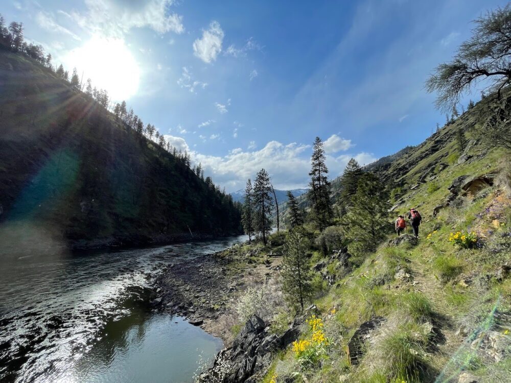
Beautiful views along the Salmon River are abundant! Photo by Kelly Hewes
Duration
Multiday, overnight backpacking trip
Area
Gospel Hump Wilderness, Nez Perce-Clearwater National Forest
Difficulty Rating
3 out of 4- Steep elevation gain makes this hike strenuous
Road Considerations
From Riggins, Idaho, the Main Salmon River road to the Wind River Pack Bridge winds along the beautiful Salmon River for about an hour. This road is accessible for low-clearance vehicles.
Total hiking miles
24-mile loop (Wind River Pack Bridge to Shepp Ranch) plus jet boat ride or 48 miles out-and-back
The Hike
The majority of this route was recently cleared by a 20-person ITA crew that based out of Sheep Creek. The hike can be done two different ways. It could be an out-and-back hike totaling 48 miles. Or it could be done as a loop starting or ending with a jet boat shuttle up the Salmon River to cut half the mileage out. Depending on how many miles a day you are comfortable backpacking, this hike could be done in two to four days plus the jetboat shuttle. See places to camp in the camping section below!
The trail starts at the Wind River Pack Bridge up the Main Salmon River. The first 10 miles of this trail climbs 3,200 feet, from 2,000 to 5,200 feet in elevation with some ups and downs in between on the way to Johnson Saddle. The trail passes below stunning Butzien Butte and Black Butte up to the sweeping view of the Gospel Hump and the Frank Church Wilderness across the Salmon River to the south from Johnson Saddle. From here, the trail works its way down 2.7 miles to Sheep Creek. The trail passes through some lush vegetation along the creek for another 2.5 miles to the Sheep Creek beach and the Main Salmon River. From there, the trail leads up along the Salmon River 8.5 miles of beautiful river views to the beach at Shepp Ranch (the ranch is not currently open to the public) which makes a good place to get picked up or dropped off by a jetboat. Look out for big horn sheep along the way!
If you are considering hiring a jet boat shuttle to start or end your hike, some suggestions are Mackay Bar Outfitters and China Bar Lodge.
Places to camp along the way
There is a great camping spot where the trail crosses Chittam Creek, short of halfway to Sheep Creek but a good break after the climb from the pack bridge. There is also good camping at Johnson Saddle. The beach at Sheep Creek has some nice places both on the beach and across the bridge to camp but there are small patches of poison ivy here and there so watch for that. Along the Salmon River, there are good places to camp at beaches along the trail.
Note: Please contact the Slate Creek Ranger District, Nez Perce-Clearwater National Forest, if you plan to make this a pack trip with stock. As of late April, the trail from Wind River Pack Bridge to Johnson Saddle had four logs across it but the Forest has plans to clear it summer 2022. Otherwise, the trail is in great shape as the Forest maintains it every year.
Things to consider
The trail along the river is at a low elevation and can be very hot in the summer months. Plan accordingly! There have been reports in the late spring of numerous rattlesnakes along Sheep Creek and there are patches of poison ivy here and there along the Main Salmon River trail.

Camping at Sheep Creek is a great option. Photo by Dave Beck
Gaia map: Click here to see elevation gain, distance, and other info about the hike!


Leave A Comment