Our Trail Spotlight highlights day trips to multi-day hikes across Idaho. Trail conditions can change quickly- swollen rivers can become impassable, windstorms can knock trees down across trails, and snow can come earlier than expected. Please take these recommendations as a jumping off place and do additional research to understand current conditions and keep yourself safe if you choose to hike this trail. Physical guidebooks and maps are always good to have or check out some online resources like Alltrails.com for updated trail reports. If your trip is as awesome as you hope it will be, please share photos and feedback!

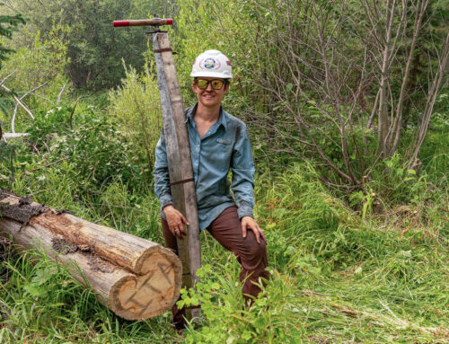
Photo by Alisa Rettschlag
Trail Spotlight: Nez Perce Trail #13 (better known as Magruder Ridge)
Recommended by: Alisa Rettschlag, ITA Crew Leader
Duration: Day hike
Area: Bitterroot National Forest
Difficulty Rating: 5 out of 5 (for route finding and lack of water)
Road Considerations: To get to the trailhead, there are a couple of ways. The easiest but longest way is to go to Conner Cutoff just south of Darby, MT (~318 miles from Boise). Drive the Conner Cutoff road for just over a half mile until you get to a T. Turn left here onto the West Fork road (HWY 473) and follow this road for 11.3 miles. At the Y, take the right fork onto the Nez Perce road (FS 468) and follow this road for 34.9. The Nez Perce road turns into the Magruder Corridor. At Magruder Crossing, turn left to continue to follow the Magruder Corridor for another 8.6 miles. The trailhead will be on the right and will have a historical sign that details the Magruder Massacre (discussed later).
A shorter way but possibly more difficult way to the trailhead is to drive the Magruder Corridor from Elk City, Idaho to the trailhead, approximately 63 miles. The trailhead is about 2.5 miles past the Observation Point Campground and it will be on the left side of the road. The Magruder Corridor is not too bad until Poet Creek. After this point, a 4×4 vehicle is recommended, and at the least, a full-size spare tire with a working jack.
Total Hiking Miles: 10
The Hike:
This trail holds a lot of history and significance to Idaho. It is a small piece of the 1,170-mile Nez Perce National Historic Trail created in 1986 and now managed by the U.S. Forest Service. The whole trail stretches from Wallowa Lake, Oregon, across Idaho to the Bear Paw National Historic Trail in Chinook, Montana. This trail follows the route taken by a large group of people of the Nez Perce tribe in 1877 as they fled to avoid being forced onto a reservation.
It is also famous (and named Magruder Ridge) for the murder of Lloyd Magruder, a merchant selling and hauling goods for the miners, and his four companions. Magruder was carrying $30,000 worth of gold along with supplies in wagons as he and his employees made their way along this part of the Nez Perce Trail (#13). One night in 1863, he was axed to death in his sleep by Christopher Lowery. Along with two companions, Christopher Lowery killed the rest of Magruder’s men, stole the money and fled to San Francisco. They were eventually captured and escorted back to Idaho to stand trial. And in 1864, they became the first “legal executions” in Idaho.
The trail in its current condition is quite overgrown and difficult to find in sections. This summer, Idaho Trails Association put two crews on this section of trail at different times to try to start the clearing and redefining. Approximately 5 of the 8 miles are cleared from the trailhead to the area where the trail starts to descend to the Selway River. There are no obvious places to filter water along the trail. For this reason, it is not a good backpacking trail.
It starts at an elevation of about 6,000 feet. The first mile traverses the side hill through a recent burn with fairly flat walking. At approximately 1.3 miles, there is an easy-to-miss junction. Take the trail on the right. The left trail looks more traveled—thus, why the junction is easy to miss. The trail starts to climb here to the high point at the top of Magruder Mountain at about 3 miles (elevation 7420 feet). After this, it is a little up and down on the ridge until it starts to descend at 4.8 miles (elevation 6820 feet). This is the end of the cleared section of trail. After this point, there are large sections of overgrown ceanothus and downed logs on tight switchbacks, descending steeply nearly 3 miles to the Selway River that sits at an elevation of 3600 feet.

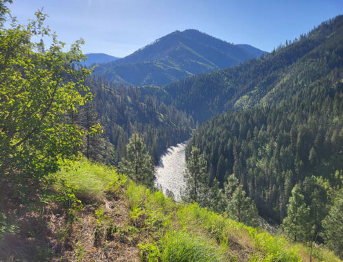
Photo by Kim Yauchzee

Photo by Kim Yauchzee

Photo by Gregg Rettschlag
Things to consider: Bring either a good GPS or a phone app to help navigate this trail. There will be times where you will lose the trail—look for recently cut logs or purposely placed logs that delineate the trail corridor. Again, there is no water on this trail so bring plenty of water.
Plan on camp up at the Observation Point Campground that sits at 7,642 feet elevation. It has a very new, nice, clean pit toilet, and one can view the amazing stars at night.
If you want to read up on the history of this trail and area, the following books give good accounts:
- The Magruder Murders: Coping with Violence on the Idaho Frontier by Julia Conway Welch
- This Bloody Deed: The Magruder Incident by Ladd Hamilton
- Chief Joseph and the Plight of the Nez Perce: the Untold Story of an American Tragedy by Ken Nerburn
- I Will Fight No More Forever Chief Joseph and the Nez Perce War by Merrill D Beal
- Thunder in the Mountains: Chief Joseph, Oliver Otis Howard, and the Nez Perce War by Daniel Sharfstein
There is also a great driving tour of the Nez Perce Trail you can learn more about here.

Leave A Comment