Our Trail Spotlight highlights day trips to multi-day hikes across Idaho. Trail conditions can change quickly- swollen rivers can become impassable, windstorms can knock trees down across trails, and snow can come earlier than expected. Please take these recommendations as a jumping off place and do additional research to understand current conditions and keep yourself safe if you choose to hike this trail. Physical guidebooks and maps are always good to have or check out some online resources like Alltrails.com for updated trail reports. If your trip is as awesome as you hope it will be, please share photos and feedback!

A filtered view of Scotchman Peak from the bench at mile one. Photo by Phil Hough.
Trail Spotlight: Gold Hill Trail #3 (Snowshoe Edition)
Recommended by: Phil Hough, Advisory Council Member
Duration: Day Hike
Area: Idaho Panhandle National Forests
Difficulty Rating: 3 out of 5 – Moderate winter terrain with steady elevation gain (1,555 feet total). Ice and Snow depth and condition (how much trail breaking in needed) will significantly impact difficulty.
Road Considerations:
From Sandpoint, take Hwy. 95 south 2 miles to Bottle Bay Road; turn left onto Bottle Bay Road and go 4.8 miles to the trailhead located on the right. In winter, expect snow-packed or icy conditions. Parking is often plowed. If there the parking lot is not available, roadside parking may be possible, but vehicles must be completely off the road, often not possible in winter.
Total hiking miles: 6.5 miles round trip (out-and-back) with approximately 1,555 feet of elevation gain.
The Hike:
Gold Hill Trail #3 offers a year round classic North Idaho hike. Open year round to hikers, mountain bikers and the occasional equestrian, it is closed to motor vehicles. Winter brings a special majesty to the landscape and views. The trailhead’s proximity to a paved road, maintained year-round makes it an easily accessible snowshoe hike in winter.
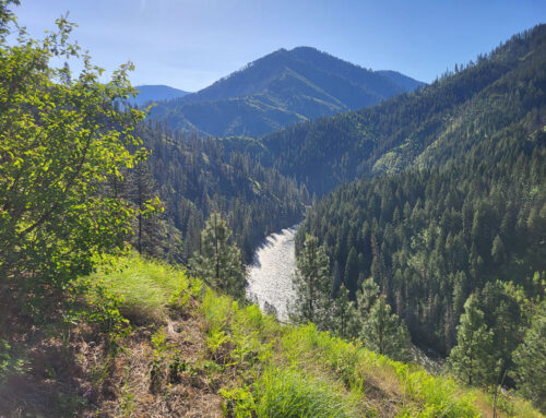
The trail begins near lake level on northeast facing slopes with plants and trees common in wet habitat, including ferns and cedars. Both of these evergreens pop out against the white backdrop of snow. The trail climbs slowly with switchbacks for the first mile to a bench and filtered views to the east of the Cabinet Mountains and Scotchman Peak.
After a few more switchbacks, the trail climbs along a ridge, with pockets of wetlands, mosses and birch. The lower slopes may be muddy or icy, but at mid-winter, the snow usually starts here on the ridge. Route finding is not a problem as the pathway through the trees is obvious and the trail is frequented by hikers throughout the year.
Use caution and stay left as you pass by new junctions after a little more than 2 miles. The steady climb through mixed conifer woods continues. As the ridge ascends more steeply, a few more switchbacks bring you to dry slope Ponderosa Pines and the first of two openings, each with benches and views. The city of Sandpoint are to the north, with the Selkirk Mountain rising just beyond. To the west, Lake Pend d’Oreille flows out through a gap in the gently declining Selkirk mountains. If you carry a headlamp, you might enjoy sunset before heading back down.
Wildlife tracks are common along the route—in winter watch for deer, moose, squirrells and snowshoe hare.

Snow much fun! Photo courtesy of Phil Hough.

Sometimes in winter all that is needed are boots. Photo by Phil Hough.

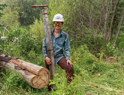
Ideal for small groups. Easy enough for all experience levels. Photo courtesy of Phil Hough.
Things to consider:
• Snow depth and trail conditions vary widely—bring traction for boots, snowshoes, poles.
• Expect colder temperatures and shorter daylight hours. Bring a headlamp and/or flashlights.
• Cell service can be limited.
• Avalanche risk is generally low on the main trail corridor but always check regional forecasts and the Idaho Panhandle Avalanche Center (IPAC) for current conditions
• Dress in layers and pack extra food, water, and emergency supplies.
More info about this hike:
See elevation map here.

Leave A Comment