
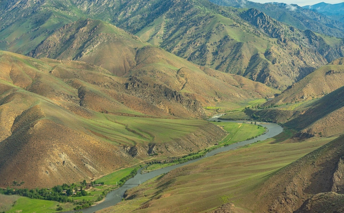
On ITA’s annual “A” Team (A stands for awesome) project, we are working on the Waterfall Trail off the Middle Fork Salmon River deep in the Frank Church River of No Return Wilderness. Idaho Fish and Game has provided funding and identified this as a priority trail for access for hunters, hikers, and backpackers. The Waterfall trail spans from the Middle Fork into the Big Horn Crags and is part of the Idaho Wilderness Trail. The lower five miles of Waterfall need the most work. Mainly brushing, and tread work with more log out as the trail climbs.
From McCall, we’ll fly into the Flying B Ranch where they will pack us into our first base camp at the bottom of the Waterfall Trail. It will be a 12-mile hike downstream along the Middle Fork on the first day. Base camping at the bottom, we’ll work our way up, moving camp as needed. At the end, we will have the Flying B pick up our gear at the last base camp and we will return to the Flying B via day hike. Finally, from here flying back to McCall.
Project information is subject to change. Crew leaders will communicate via email. Failure to respond to your crew leader may result in being dropped from the project. See our FAQs, reach out to your crew leader, or contact ITA staff at trails@idahotrailsassociation.org if you have questions.
Trails: Waterfall #6045
Itinerary: This is a weeklong project, Thursday to Wednesday. From McCall, we’ll fly into the Flying B Ranch where they will pack us into our first base camp at the bottom of the Waterfall Trail. It will be a 12-mile hike downstream along the Middle Fork on the first day. Base camp at the bottom, we’ll work out way up moving camp as needed. At the end, we will have the Flying B pick up our gear at the last base camp and we will return to the Flying B via day hike. Finally, from here flying back to McCall.
Food Provided by ITA: No
Crew Leader: Dave Beck
Estimated Drive Time from Closest Town: Flying out of McCall
Trail Map: Gaia Map with Elevation Profile of Waterfall Trail and Trail from the Flying B to Waterfall.
Refundable deposit: $50
Why do I need to pay a deposit? We’ve had trouble with people backing out of trips at the last minute which can really affect the productivity of the overall project. By charging a refundable fee, volunteers are less likely to cancel their reservation. Refunds will not be given to volunteers that do not show up or cancel their reservation. Exceptions will be made for medical reasons or unforeseen circumstances. Volunteers can choose to donate the deposit to ITA. All donations are tax-deductible and will go towards maintaining trails throughout Idaho. If you require assistance in paying for this fee, please contact us at trails@idahotrailsassociation.org and we will waive the cost.
Difficulty Rating


Volunteer Spots Available: 0 of 8
If there are no volunteer spots available, click “Sign Up” to get on our waitlist for this project!