Our Trail Spotlight highlights day trips to multi-day hikes across Idaho. Trail conditions can change quickly- swollen rivers can become impassable, windstorms can knock trees down across trails, and snow can come earlier than expected. Please take these recommendations as a jumping off place and do additional research to understand current conditions and keep yourself safe if you choose to hike this trail. Physical guidebooks and maps are always good to have or check out some online resources like Alltrails.com for updated trail reports. If your trip is as awesome as you hope it will be, please share photos and feedback!

Photo by John McCarthy
Title: Perjue Canyon
Recommended by: John McCarthy, ITA advisory board member, ITA crew leader and conservation leader on Owyhee Wilderness negotiations.
Duration: Day Hike, possible backpacking
Area: Little Jacks Creek Wilderness, BLM
Difficulty Rating: 1 to 2, suitable for all hikers of all ages.
Road Considerations: the Mud Flat Road or Owyhee Scenic Byway is a gravel road accessible by passenger cars with good tires and care. It can be icy and snowy in winter months and spongey in early Spring, when it is best to be avoided.
Total hiking miles: 7.3 miles from Mud Flat Road on west side of wilderness to mouth of Shoofly Creek on south side of wilderness, out and back or as far as desired.
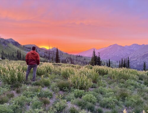
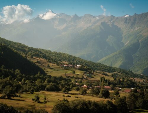
The Hike: Perjue Canyon can be an early spring season or late fall hike, or anything in between, only about one hour-15 minute drive from downtown Boise. The hike starts at a small parking lot next to the Mud Flat Road, shown on some maps as L and L Ranch, up the road from the Poison Creek picnic area where there is a pit toilet. Hikers go through the gate into the Little Jacks Creek Wilderness on a short section of roadway that may someday provide additional short vehicle access. The single track trail is adapted from an old homestead route and starts about 1/4 mile in, marked by a creative sign. The trail goes uphill at a steady grade to a stand alone rock outcropping, which is the highest point on the trail and provides youngsters a rock climbing opportunity. The trail proceeds downhill into the Snow Creek headwaters, going past the remains of an old log homestead cabin. The trail continues to wind through sagebrush into Perjue Canyon itself, alongside Shoofly Creek. The canyon features walls and rock-faces, although not as steep or shear as some in the Owyhee. The trail crosses the creek in jump-overs and cruises through alder and aspen groves, with sections in the open for broader views. There are opportunities to climb up the canyon-sides for additional views and explorations, including climbing up to the ridge known as Between the Creeks separating the East and West Forks of Shoofly Creek.

Photo by John McCarthy

Photo by John McCarthy
Places to camp along the way: Rough backpacking camp options are possible along the creek, with some flatter spots away from the trees.
Things to consider: Rattlesnakes are present, as well as is scattered poison ivy. Shoofly Creek is a year round stream and can be filtered. The first couple miles are in the open without shade. Trees in the riparian area along Shoofly Creek do provide shade.
ITA has opened up this trail from both directions, working with the BLM. Trail conditions are variable year to year.

Photo by John McCarthy

Photo by John McCarthy

Photo by John McCarthy

Leave A Comment