Our Trail Spotlight highlights day trips to multi-day hikes across Idaho. Trail conditions can change quickly- swollen rivers can become impassable, windstorms can knock trees down across trails, and snow can come earlier than expected. Please take these recommendations as a jumping off place and do additional research to understand current conditions and keep yourself safe if you choose to hike this trail. Physical guidebooks and maps are always good to have or check out some online resources like Alltrails.com for updated trail reports. If your trip is as awesome as you hope it will be, please share photos and feedback!
Trail Spotlight: Cottonwood Creek #189
Duration: Reservoir
Area: Boise National Forest
Difficulty Rating: 4 out of 5, lots of elevation gain and tricky creek crossings.
Road Considerations: If you start hiking out of Idaho City at the northern end of the trail, do not follow the driving directions from Google. Follow the directions listed here on the Forest Service’s Bald Mountain Campground page. The trailhead is up the road a half a mile or so from the campground. For starting at the south end of the trail, follow the directions here for getting to the Cottonwood Creek Campground. The trail starts nearby.
Total Hiking Miles: 16 miles out and back
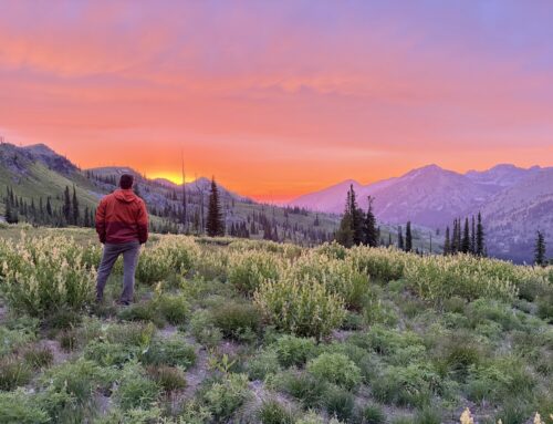
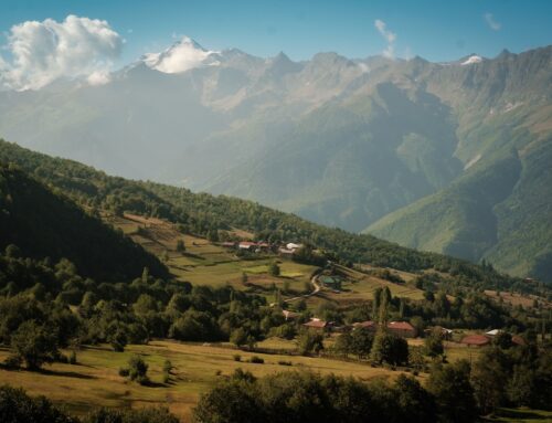
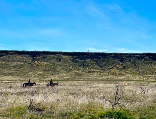
The Hike: The Cottonwood Creek trail can be accessed by car from either the north end near Idaho City or the south end near Arrowrock Reservoir. With beautiful wildflowers and panoramic views from the Thorn Creek Lookout at the top, this trail is a rare non-motorized gem in the Boise National Forest! ITA recently cleared the first few miles of the north end of the trail and a conservation corps crew worked the first four miles from the bottom of the trail in 2024. If hiking down from the top, be prepared for a big climb back up! With camping available on both ends of this hike, the trail can be done as a long day hike or split up as a shorter backpacking out and back trip. If starting from the bottom of the trail near Arrowrock Reservoir, the trail climbs a total of 3,346 feet to reach the upper end of the trail near Bald Mountain. Once the top of the trail is reached, the Thorn Creek Lookout can be accessed by walking another two miles on dirt roads.
Places to camp along the way: Besides the established Bald Mountain Campground on the north end of the trail and the Cottonwood Creek Campground on the south end, there are a number of nice camp spots along the trail for backpacking.
Things to consider: In early spring, there are a few creek crossings starting three or so miles in from the south made worse by beaver dams that can make this a wet hike and the trail hard to find. There are also parts of the trail that have little shade and can get very hot in the summer months.
More info about this hike: See AllTrails for reviews and up to date reviews.

Photo by Trey Dozier

Photo by Kelly Hewes

Photo by Mark Hewes

Leave A Comment