Our Trail Spotlight highlights day trips to multi-day hikes across Idaho. Trail conditions can change quickly- swollen rivers can become impassable, windstorms can knock trees down across trails, and snow can come earlier than expected. Please take these recommendations as a jumping off place and do additional research to understand current conditions and keep yourself safe if you choose to hike this trail. Physical guidebooks and maps are always good to have or check out some online resources like Alltrails.com for updated trail reports. If your trip is as awesome as you hope it will be, please share photos and feedback!

Photos by Steve Hunter
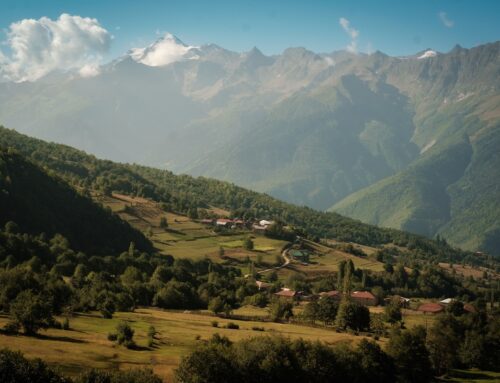
Trail Spotlight: Sixty-Two Ridge
Recommended by: Clay Jacobson, ITA Idaho Centennial Trail Coordinator
Duration: Overnight Backpacking
Area: Selway Bitterroot Wilderness, Nez Perce-Clearwater National Forest
Difficulty Rating: 4, Steep and dry ridge climb, downed trees, overgrown trail
Road Considerations: Selway Road is in good shape and suitable for most vehicles
Total hiking miles: 11 miles to access the trail, 9 miles to Big Rock Mountain
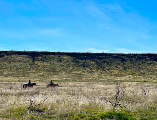
The Hike: From the Race Creek Campground at the end of the Selway Road, the Selway River Trail provides a meandering riverside hike for the first 11 miles. At the Mink Creek Bridge the Sixty-Two Ridge trail does a steep climb through open ponderosa slopes with sweeping views of the Selway River Canyon. The climb levels out at Bear Wallow Springs, where massive bull elk come to relax in the marshy meadows. After gaining the ridge, the trail continues a gentle ascent along the forested fall-line. Once reaching the treeline the ridge remains wide open until the highpoint at Big Rock Mountain with endless views of the Northern half of the Selway Wilderness. El Capitan dominates the mountainous border with Montana to the East. There are several flowing springs along the ridgeline but watch your maps so you don’t run out of water. This is a remote and rugged stretch of the Idaho Centennial Trail where you can expect a surplus of isolation. This trail was named when early forest rangers found the date ‘1862’ carved into a tree along the ridge.

Photo by Ron Abramovich

Photo by Clay Jacobson
Places to camp along the way: There is plenty of dispersed camping along the Selway River Trail. Once you start the climb up Sixty-Two Ridge, there will be limited dry camping options until you reach Bear Wallow. Once above the treeline, the ridge is broad and open so take your pick of camping spots by the nearest spring.
Things to consider: Rattlesnakes are common along the Selway River Trail and may be basking in the sun on the switchbacks at the beginning of the climb. This is an extremely remote area so be sure you are prepared to safely navigate through this tough country. A massive wind event dumped 100’s of ponderosas 2 years ago and there are many sections where remaining on the trail will require some technical scrambles over the toppled giants. From Bear Wallow, the trail can be very overgrown and hard to follow. After reaching the treeline, the trail is clear and open.
Fun places to visit on your way in or out: Check out the Historical Lochsa Ranger Station on Highway 12 to see the long-gone glory days of the Forest Service. The Selway Wilderness was a shining example of the grand dreams for our public lands in the early days of the agency.
Want to join a volunteer trip on this trail? Check out our 2026 Sixty-Two Ridge Project here.

Leave A Comment