Project Name: Liz Butte
Project Dates: July 6-11
In the Nez Perce Clearwater National Forest, Liz Butte sits high above the Lochsa River, between the Clearwater and Bitterroot Mountains. To get to this project, volunteers will have a chance to explore the Lolo Trail Corridor, which climbs from Highway 12 and follows ridgelines through old growth forest, meadows, and peaks. This corridor is made up of the Nee Me Poo National Historic Trail plus the Lewis and Clark National Historic Trail and is about 90 miles long spanning from the western end at Musselshell Meadows to Lolo Pass where it passes into Montana.
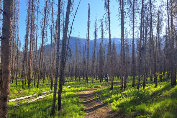
With food and a volunteer cook provided, we'll car camp together in the shade along the road just below the lookout. We'll be a short hike or drive to both the lookout and to the Liz Butte Trail. There are lots of trees and saw work expected at the beginning where the trail passes through an old burn scar for the first two miles. The second two miles switchbacks down to Weitas Creek out of the burned areas and will need more tread work and brushing!
Part of the Idaho Centennial Trail, ITA is committed to maintaining sections of this 1000-mile trail each year. Over the coming years we plan to build off this work and continue this section where it climbs out of the other side of Weitas Creek.
Project information is subject to change. Crew leaders will communicate via email. Failure to respond to your crew leader may result in being dropped from the project. See our FAQs, reach out to your crew leader, or contact ITA staff at trails@idahotrailsassociation.org if you have questions.
Trails: Liz Butte Trail # 649 and Yokum Creek Trail #650
Itinerary: This is a Monday to Saturday 6 day project. Meet at Liz Butte Monday afternoon to set up camp. Work Tuesday – Friday. Saturday morning, clean up camp and head home.
Food Provided by ITA: Yes
Gear Packing List: Gear Checklist for Car Camping, Food Provided
Crew Leader: Clay Jacobson
Estimated Drive Time from Closest Town: About 3 hours from Kooskia
Trail Map: Click for trail map and elevation profile
Refundable deposit: $50
Why do I need to pay a deposit? We've had trouble with people backing out of trips at the last minute which can really affect the productivity of the overall project. By charging a refundable fee, volunteers are less likely to cancel their reservation. Refunds will not be given to volunteers that do not show up or cancel their reservation. Exceptions will be made for medical reasons or unforeseen circumstances. Volunteers can choose to donate the deposit to ITA. All donations are tax-deductible and will go towards maintaining trails throughout Idaho. If you require assistance in paying for this fee, please contact us at trails@idahotrailsassociation.org and we will waive the cost.
Difficulty Rating


Volunteer Spots Available: 9 of 12
If there are no volunteer spots available, click “Sign Up” to get on our waitlist for this project!
Waitlist Signups: 0