Our Trail Spotlight highlights day trips to multi-day hikes across Idaho. Trail conditions can change quickly- swollen rivers can become impassable, windstorms can knock trees down across trails, and snow can come earlier than expected. Please take these recommendations as a jumping off place and do additional research to understand current conditions and keep yourself safe if you choose to hike this trail. Physical guidebooks and maps are always good to have or check out some online resources like Alltrails.com for updated trail reports. If your trip is as awesome as you hope it will be, please share photos and feedback!

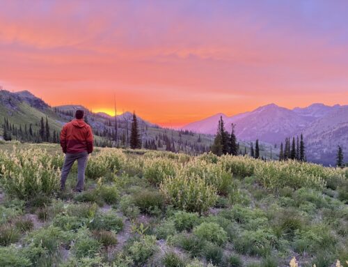
Photo curtesy Alisa Rettschlag
Recommended by: Alisa Rettschlag, ITA Crew Leader
Duration: Day Hike
Area: Idaho City, Boise National Forest
Difficulty Rating: 1 out 5– the trail is fairly flat with a few very short gradual uphill sections. There is an elevation gain of 70 feet.
Road Considerations: From Highway 21, take the main road into Idaho City, then turn left onto Wall Street. Follow this good gravel or snow-packed road to its end at the Idaho City Airport parking lot. Low clearance vehicles can easily make it to the trailhead.
Total hiking miles: 1.8 mile loop
The Hike: The ungroomed trail starts at the left of the bathrooms through a gap in the fence around the airport. The trail climbs slightly up to a bench. Along this bench, there are about 3 “Fit Stop” signs. These areas have fitness equipment such as balance beams and pull up bars. At about .5 miles, the trail for Charcoal Gulch takes off to the north. (Though Charcoal Gulch is a separate trail, it shares its trailhead with the Buena Vista Trail. AllTrails has a good trail description of the Charcoal Trail). At .65 miles, the Buena Vista Trail turns south and descends off of the bench at the far end (west end) of the airport. Once in the flats, the trail continues on around to the east and along the opposite side of the airport. At 1.6 miles, the trail splits. The left path goes back along east end airport and back to the parking lot and trailhead. The right descends slightly to a bridge that crosses Elk Creek and then through some residential areas and eventually ends at Wall Street. From here, turn left and follow the road for about .2 miles to get back to the parking lot and trailhead.
Things to consider: This airport is used for Life Flight Helicopters. There is a chance that a helicopter will need to land either in the parking lot or on the airstrip. Flying debris or even a need to move vehicles can be hazardous.
Fun places to visit on your way in or out: Idaho City itself is a historical fun little place to visit. Though there is not much open in the winter, it is still fun to walk around the town. A few restaurants stay open through the year. After skiing or snowshoeing, it’s quite the treat to get a piece of pie at Trudy’s, a Sasparilla drink at Diamond Lil’s Restaurant and Saloon or a burger at The Gold Mine. And if one needs even more relaxation after a day of fun in the snow, make a reservation for a soak at The Springs https://www.thespringsid.com/
More info about this hike: Here’s the AllTrails description of the Charcoal Gulch hike that was mentioned in this post. https://www.alltrails.com/explore/trail/us/idaho/charcoal-gulch?mobileMap=false&ref=sidebar-static-map

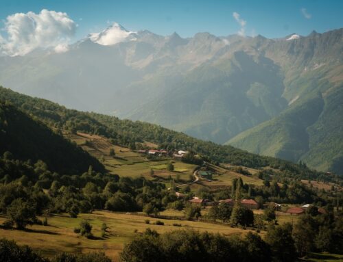
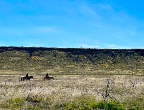
Photo curtesy Alisa Rettschlag

Photo curtesy Alisa Rettschlag

Photo curtesy Alisa Rettschlag

Leave A Comment