Our Trail Spotlight highlights day trips to multi-day hikes across Idaho. Trail conditions can change quickly- swollen rivers can become impassable, windstorms can knock trees down across trails, and snow can come earlier than expected. Please take these recommendations as a jumping off place and do additional research to understand current conditions and keep yourself safe if you choose to hike this trail. Physical guidebooks and maps are always good to have or check out some online resources like Alltrails.com for updated trail reports. If your trip is as awesome as you hope it will be, please share photos and feedback!

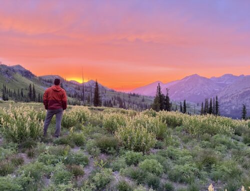
Photo by Dave Beck
Trail: South Fork Blackmare Cut-off trail accessing Blackmare Lake
Recommended by: Kirsten Severud
Duration: Late spring through fall
Area: Krassel Ranger District, Payette National Forest
Difficulty Rating: 4-Difficult, multiple stream crossings, minor route find may be required; 2800 feet of elevation gain from trailhead to lake
Road Considerations: To prevent erosion, the South Fork of the Salmon River Road is paved. This means if approaching from the south, the road is paved all the way to the trailhead located at Poverty Flats Campground. Starting in late June or early July, depending on snow levels, the trailhead can also be accessed from McCall by way of Lick Creek Road and south on the South Fork Road. In recent years, the South Fork Road has been closed for construction during the week, or with very restrictive times, so be sure to check for road closures.
Total hiking miles: 8.3 miles to Blackmare Lake, 17.5 miles round trip.
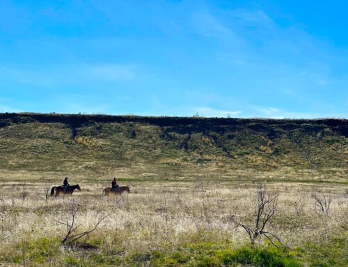
The Hike: This hike starts at the beautiful Poverty Flats Campground. There are a few trailhead parking spots at the south end of the campground where Blackmare Trail 100 begins. This beginning trail is open to hikers, horses, mountain bikes, and motor bikes. After crossing the South Fork of the Salmon River over a large bridge and a little wandering on the flats, a steep, sandy, switch-backed 200-foot elevation initial climb begins. The trail then remains high on the hillside above the main fork of Blackmare Creek gaining and losing some elevation, in and out of the central Idaho Ponderosa forest and crossing a few small side streams.
Follow Trail 100 for roughly 3.5 miles to reach the intersection with FS Trail 302, the Blackmare Cut-off trail dropping off to the south towards the confluence of the main and south fork channels. We missed the junction the first time we attempted this trail because it was so overgrown, but this is where ITA’s main work started. The junction is now signed with a Forest Service post “Trail Closed to Wheeled Vehicles,” and Trail 302 is only open to hiking and horses.
From here, the trail drops down to the South Fork Blackmare Creek. Late in the season it might be crossable without getting your feet wet, but that’s not likely in the springtime when snowmelt will keep it running cold, fast and knee deep. In the springtime, keep an eye out for dainty orchids and trillium, and many other wildflowers. From here the trail is easy to follow thanks to the numerous trail crews in recent years. Occasionally you might even see an original trail blaze.

Photo by Kirsten Severud
More info about this hike: Poverty Flat Campground is a great place to camp to get an early start and its worth checking out the informational signs about the history of the area.
Things to consider: Plan for bugs and be happy when they aren’t there! I’ve had mixed experiences. In the springtime, ticks can be prevalent. Later in the summer I have seen the mosquitos, horseflies, and deerflies be terrible. However, time it right and you might find a wide variety of wild berries as well!
Fun places to visit on your way in or out: North Shore Lodge at Warm Lake might be a good place to stop for a bite to eat, or you could check out one of the numerous hot springs in the area.
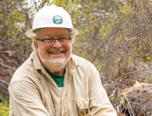
More info about this hike: Check out ITA volunteer Dave Beck’s blog series about clearing the Blackmare Lake Trail.

Photo by Don Essig
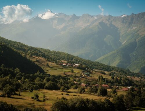
The further you go, the more the valley begins to open with views of the surrounding peaks. The trail again crosses a handful of side stream crossings where you may or may not be able to keep your keep dry, and eventually you will make two crossings of the South Fork itself, 20-30 foot wide. Just after the first of these crossings was one areas trail crews have camped at.
After the South Fork crossings, the trail will again start to climb as you approach the end of the valley. There is still a section of trail that requires some route finding where the trail peters out in a sloped open meadow. Continue uphill through this open area to meet up with the more well-defined trail again. While the trail was cleared at the end of 2023, ITA and the Forest Service have the continuing battle with downed trees. The trail after the meadow is easy to follow as you continue to climb to Blackmare Lake, but a number of downed trees still hindered the trail at the end of 2024 and will until the next crew makes it in. (On ITA’s scheduled for 2025).
At the end of this hike, you will be rewarded with a large, beautiful mountain lake. There are a few campsites located where the trail meets the lake, and smaller sites might be found elsewhere around the edge.

Photo by Don Essig

Photo by Dave Beck

Photo by Kirsten Severud

Photo by Josh Davis

Photo by Gregg Rettschlag
Leave A Comment